top of page


A BETTER
PERSPECTIVE
FOR BETTER SOLUTIONS
Professional drone, mapping and visual media services that elevate real estate, construction and commercial projects.
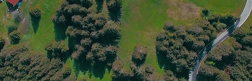
Site mapping
Accurate data.
Smarter decisions.
3D Modeling
Detailed models.
Better planning.
Aerial Media
Stunning visuals.
Stronger impact.
VETERAN-OWNED AND OPERATED
OUR SERVICES
POWERFUL SOLUTIONS. REAL RESULTS.


Real Estate Media
Photos, videos, 3D tours and more to showcase your property at it's best.
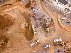
Construction Solutions
Progress tracking, site mapping, and data that keep your projects on time and on budget.
Commercial Services
Aerial inspections, marketing media, and mapping for commercial properties

WHY CHOOSE LANCE GEOSPATIAL SOLUTIONS?
-
Veteran owned and operated
-
Professional and fully insured
-
Advanced technology
-
Fast turnaround
-
Reliable. Accurate. Local.
bottom of page